The Red Zone Is Gone. The Language Remains. What Is Carlton County Really Planning for County Road 4?
County Commissioner Susan Zmyslony confirms that the proposed Regional Commercial designation at I-35 and County Road 4 has been removed from Carlton County's preliminary 2050 land-use map. But the County's latest planning memorandum continues to identify County Road 4 as a corridor for regional commercial development. What changed, what didn't, and what should residents believe?
By Carlton County Watch
The County Road 4 Development Proposal Has Taken an Interesting Turn
The proposed designation was not insignificant.
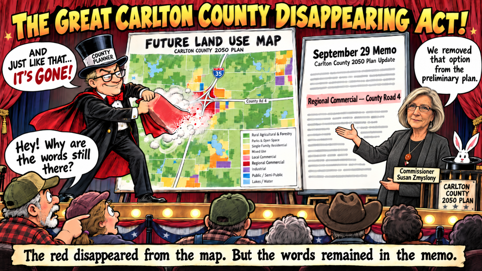
According to the County's planning consultant, Houseal Lavigne, Regional Commercial uses include larger retailers, national restaurant chains, gas stations, hotels, and other businesses intended to attract customers traveling through the region.
The proposed designation appeared in bright red on the County's preliminary Future Land Use Map, presented during the August 5, 2026, joint meeting of the Carlton County Board of Commissioners and Planning Commission.
For an area characterized by farmland, rural residences, and agricultural activity, that designation raised legitimate questions about the County's long-term vision for the corridor.
County officials subsequently emphasized that the plan was preliminary and that no actual development had been approved.
That distinction was important then, and it remains important today.
But something has changed.
The bright red Regional Commercial designation surrounding the I-35/County Road 4 interchange has disappeared from the County's updated preliminary map.
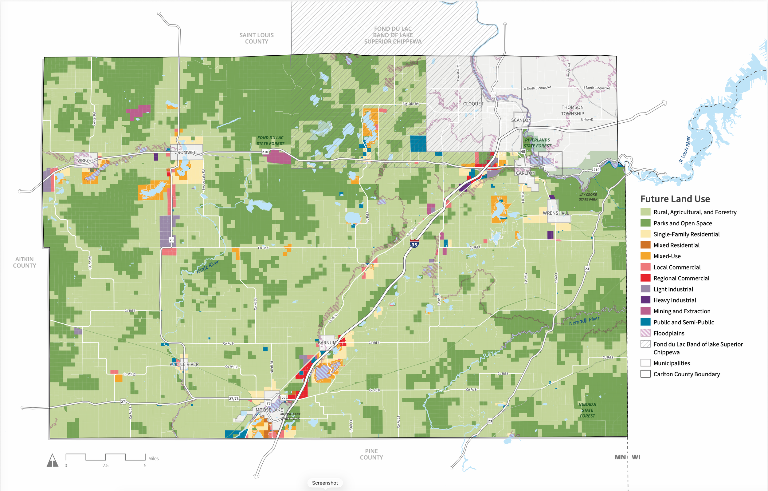
And now, we have confirmation directly from a Carlton County Commissioner explaining why.
Commissioner Zmyslony Confirms the Designation Was Removed
On October 6, 2026, Carlton County Watch contacted Commissioner Susan Zmyslony, County Administrator Dennis Genereau, and Zoning and Environmental Services Administrator Chris Berg seeking clarification about the status of the I-35/County Road 4 proposal.
Our questions followed reports from residents that Commissioner Zmyslony, while canvassing the area for her re-election campaign, had expressed opposition to the proposed development designation.
On October 7, Commissioner Zmyslony responded in writing.
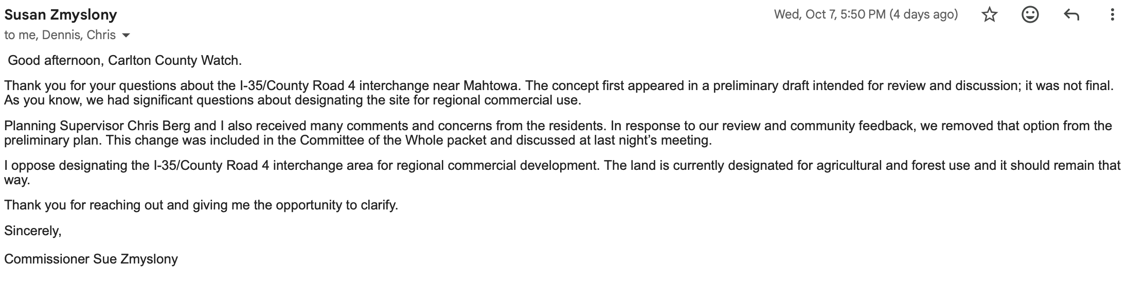
She explained that the Regional Commercial concept had appeared in a preliminary draft, not a final plan, and that County officials had received substantial public feedback about the proposal.
Most significantly, she stated:
"In response to our review and community feedback, we removed that option from the preliminary plan."
Commissioner Zmyslony also made her personal position:
"I oppose designating the I-35/County Road 4 interchange area for regional commercial development."
She added that the land is currently designated for agricultural and forest use and should remain that way.
The Commissioner further reported that the change was included in the October 6 Committee of the Whole packet and discussed during that meeting.
This is an important development.
The County has now expressly acknowledged that the Regional Commercial option appeared in the original preliminary plan, generated questions and concerns, and was subsequently removed from the preliminary map.
It is also a reminder that public participation in government planning can have tangible consequences.
But our examination of the County's latest documents uncovered another issue.
The Map Changed. The Written Plan Didn't Fully Follow.
Included in the October 6, 2026, Committee of the Whole agenda packet is a September 29 memorandum prepared by Houseal Lavigne.
The memorandum is titled Vision Statement, Goals, and Preliminary Land Use Plan and is intended to help guide development of Carlton County's 2050 Comprehensive Plan.
The updated Future Land Use Map appears on page 24 of the October 6 agenda packet.
And, indeed, the previously depicted red Regional Commercial designation surrounding the I-35/County Road 4 interchange is gone.
But turn back five pages.
On page 19, under the heading Regional Commercial, Houseal Lavigne continues to identify County Road 4 as a corridor for that category of development.
The memorandum describes the category as including large-scale, automobile-oriented businesses and specifically lists I-35, Minnesota Highway 210, and County Roads 4, 6, and 8 among the transportation corridors associated with regional commercial uses.
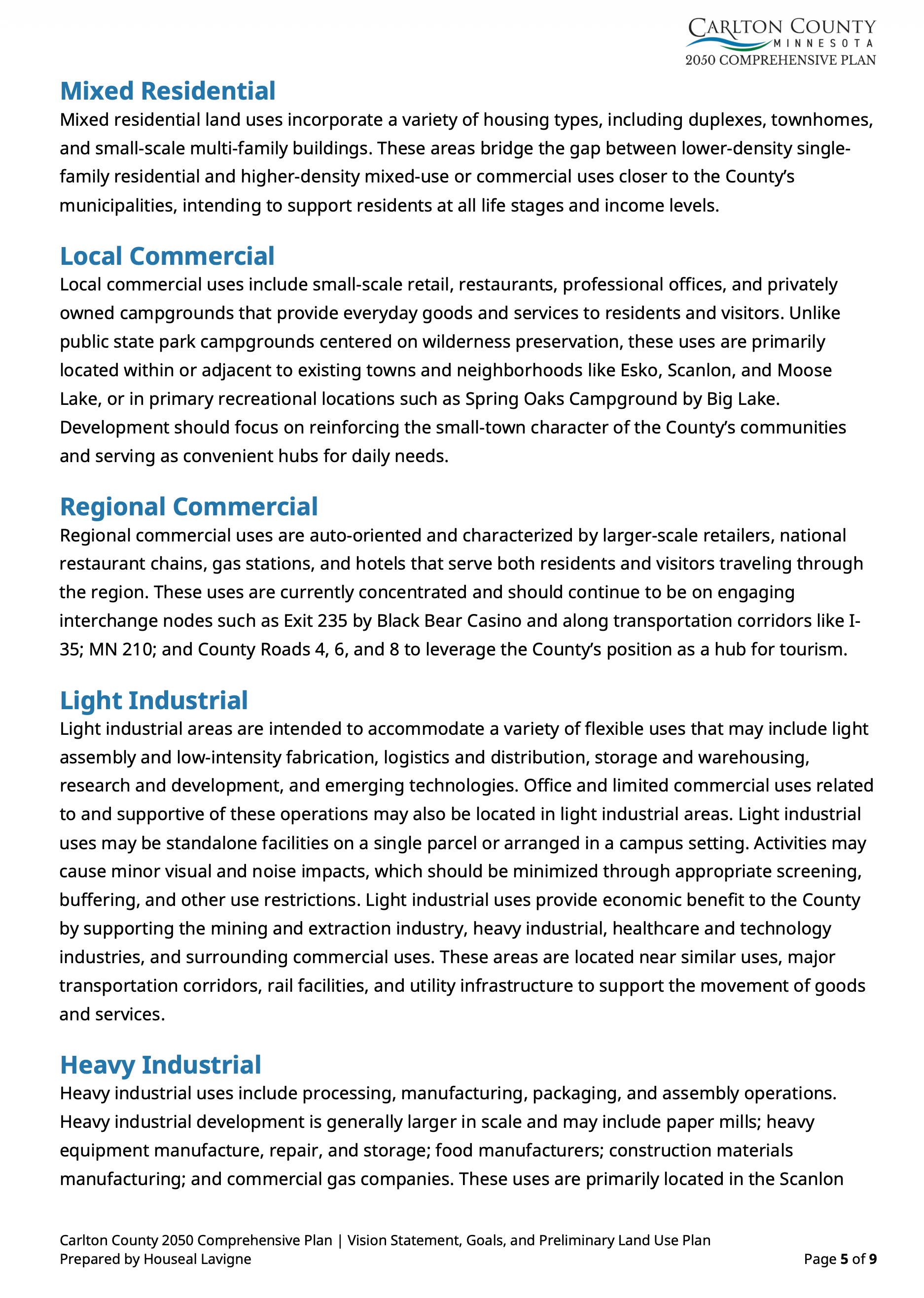
County Road 4 remains in the written recommendations, even though the specific commercial designation at its I-35 interchange has been removed from the map.
The language is substantially unchanged from the original July 7 memorandum presented to County officials in August.
That discrepancy matters.
To be clear, County Road 4 extends well beyond the I-35 interchange. The remaining written reference could concern other locations along the road without including the interchange itself.
It could also be an editing oversight in a draft document that is still evolving.
But until the County explains the relationship between the map and its written recommendations, residents are left with two documents that invite different interpretations.
The obvious question is:
If Regional Commercial development at the I-35/County Road 4 interchange has been removed from consideration, why does the latest written planning memorandum still identify County Road 4 as a Regional Commercial corridor?
There may be a perfectly reasonable explanation.
The public deserves to hear it.
And What About Mixed-Use Development in Mahtowa?
There is another provision in the September 29 memorandum that deserves attention.
On page 18 of the October 6 agenda packet, Houseal Lavigne continues to identify Mahtowa as one of the County's unincorporated rural centers targeted for a Mixed-Use land-use designation.
Mixed-Use is a separate classification from Regional Commercial.
The memorandum describes Mixed-Use development as combining commercial and residential activities, potentially including shops, services, and residential units within the same building or development area.
Such development is generally more intensive than surrounding low-density rural uses.
The document also discusses strategic intersections along major County corridors as potential Mixed-Use locations.
This does not establish that Carlton County intends to rezone individual properties in Mahtowa or that any particular development project has been approved.
Nevertheless, it demonstrates that removing the Regional Commercial designation at the interchange does not mean every potential change in land use around Mahtowa has been abandoned.
Residents should understand the difference.
A preliminary land-use map is not a building permit. Nor does it, standing alone, change a property's existing zoning.
But the County's own memorandum explains that future land-use designations are intended to guide development review and future zoning amendments.
The words accompanying the map therefore matter.
Remember When County Officials Said Carlton County Watch Got It Wrong?
Readers may recall the response to our original August reporting.
In an August 14, 2026, article titled Administrator asks citizens to call with questions, Pine Knot News reporter Jana Peterson reported that County officials believed Carlton County Watch had not accurately portrayed the August 5 planning meeting.
The article also acknowledged that the preliminary land-use map showed the County Road 4 interchange as Regional Commercial.
County Administrator Dennis Genereau emphasized that the plan was unfinished and suggested that development at that particular interchange was highly unlikely.
Those statements provided useful context.
But they did not change what appeared on the County's published map.
Our original reporting identified the designation as preliminary. We raised questions about its potential implications and the relationship between proposed commercial growth and preservation of the County's agricultural heritage.
Now, Commissioner Zmyslony has confirmed that the designation was subsequently removed.
The original red designation was real. The public questions were real. And the subsequent map revision is real.
That does not establish that the County ever approved commercial development at this location, nor does it mean that every concern raised in August has been resolved.
It does, however, reinforce an important distinction: identifying and questioning a proposal appearing in a public planning document is not the same as claiming the proposal has already been adopted.
Residents have every right to examine preliminary government documents, question their contents, and ask elected officials to explain them.
That is precisely what public participation is supposed to accomplish.
Public Participation Shouldn't Require Guesswork
Carlton County's 2050 Comprehensive Plan will help shape the County's development priorities for decades.
It addresses agriculture, housing, commercial development, transportation, infrastructure, conservation, and economic growth.
Those are important decisions, and reasonable residents can disagree about them.
Some residents favor additional commercial activity near interstate interchanges. Such development could create jobs, provide services, and expand the property-tax base.
Others are concerned about farmland conversion, traffic, changes to rural character, and whether existing infrastructure can accommodate additional development.
Neither perspective should be dismissed.
The planning process exists to weigh these competing interests and develop policies the public can understand.
But that process also requires consistent documentation.
If a land-use recommendation changes following public feedback, the County should clearly identify what changed, why it changed, and whether associated written recommendations have been revised accordingly.
Residents should not have to compare successive agenda packets and interpret subtle differences between maps and consultant memoranda simply to determine the County's current intentions.
Five Questions That Remain
Commissioner Zmyslony's October 7 response provides meaningful clarification, but several questions remain unanswered:
Does the September 29 memorandum's reference to County Road 4 still encompass the I-35 interchange, or does it refer exclusively to other portions of the corridor?
If the interchange is no longer being considered for Regional Commercial designation, will the written planning recommendations be revised to clarify that decision?
When was the mapped designation removed, and what review or direction led to that revision?
What, if any, changes are contemplated for Mahtowa under the separate Mixed-Use classification?
How will Carlton County ensure that future draft maps, written recommendations, and public communications consistently reflect the same planning decisions?
These are not accusations.
They are reasonable questions about an ongoing public planning process.
And answering them should help residents understand exactly where things stand.
The Bottom Line: The Public Is Paying Attention
There is something encouraging about this development.
Commissioner Zmyslony has acknowledged community concerns, confirmed a change to the preliminary plan, and publicly stated her opposition to Regional Commercial designation at the I-35/County Road 4 interchange.
That clarity is welcome.
The revised map reflects a meaningful change from the version presented in August.
But the work of public accountability does not end when a colored area disappears from a planning map.
A change to the map should be accompanied by clear written explanations that leave residents with no reasonable uncertainty about the policy being proposed.
The County Road 4 designation may be gone from the map.
The County Road 4 language remains in the memorandum.
And until those documents are reconciled or explained, there is still a story worth following.
Carlton County Watch will continue reviewing the County's 2050 Comprehensive Land Use Plan as additional documents and revisions become available.
Because the public should not have to guess what its government is planning.